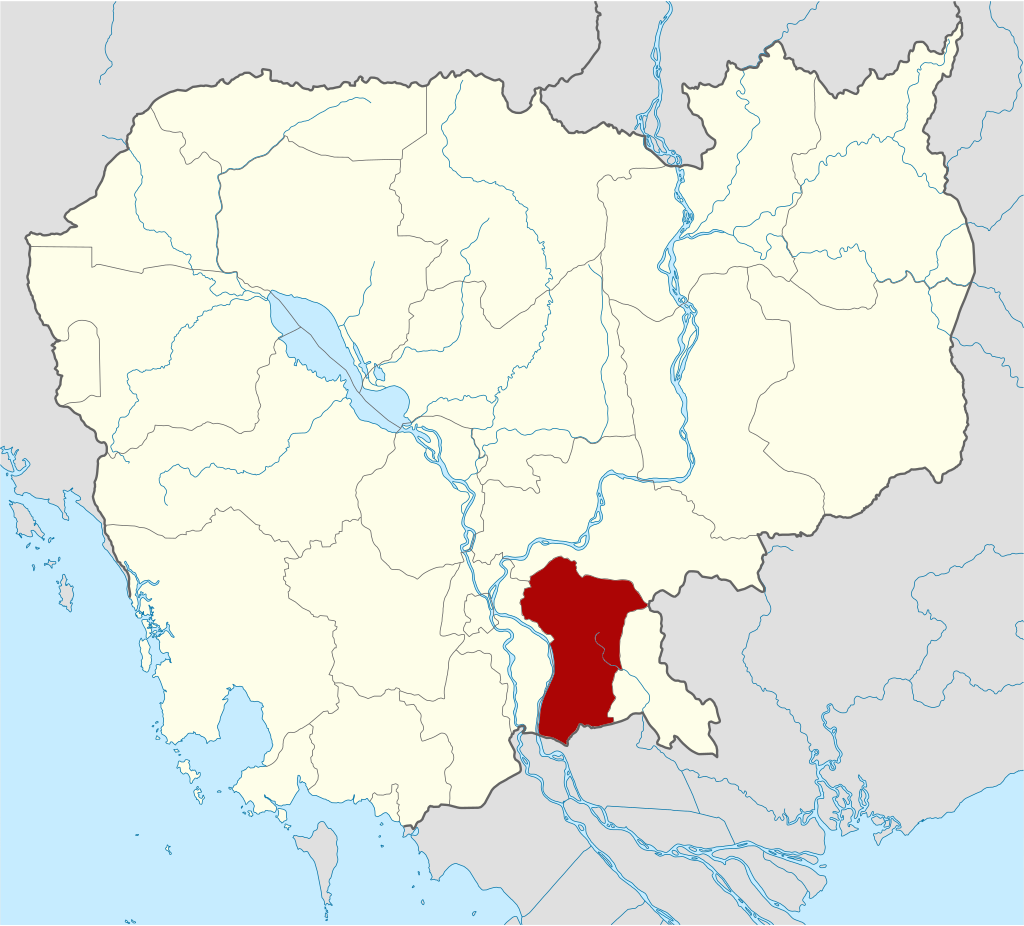
Prey Veng is, a province of Cambodia located on southeastern, about 95 kilometers from Phnom Penh along National Road 1 and 11 or 100 kilometers via National Road 8 and 11. Prey Veng, covering 4,883 square kilometers, bordered by Svay Rieng province to the east, Kampong Cham and Tboung Khmum to the northwest and northeast respectively, Kandal province to the west, and Dong Thap, Long An and Tay Ninh provinces of Vietnam to the south. Prey Veng’s location near Phnom Penh (about a two-hour drive) and its border with Vietnam makes it accessible to travelers passing through. This strategic location could support cross-border tourism and short visits from the capital.
This highly populated agricultural area is situated on the Mekong’s east bank. Although the term literally translates to “long forest” in Khmer, over the course of 30 years, the last large trees there have progressively vanished to make way for agricultural land.
Present day, Prey Veng is divided into 12 administrative districts and 1 municipality, Prey Veng City. The province has three international border gates, the Banteay Chakrei checkpoint, Koh Rokar checkpoint, Moeun Chey checkpoint; one bilateral gate called Koh Sampov, and other two regional checkpoints, the Peam Matea and Svay Ah Ngoang gates. With over 1,000,000 people (As of 2019), the province is Cambodia’s sixteenth largest area and the third most populous.
History
Prey Veng province, located in southeastern Cambodia, has a rich history that stretches back centuries, playing an important role in the country’s cultural and political development.
Pre-History or Early History Period
Prey Veng, like much of Cambodia, was part of the ancient Funan Kingdom (1st to 6th century AD) and later the Chenla Kingdom (6th to 9th century AD). These early civilizations laid the foundation for the rise of the Khmer Empire, one of Southeast Asia’s most powerful and culturally significant empires. Although Prey Veng was not the center of Khmer civilization like Angkor, it was influenced by the empire’s culture, religion, and politics. Evidence of Khmer culture from this period can still be found in the region’s architecture, especially ancient temples.
During the height of the Khmer Empire, Prey Veng was a key agricultural region. Its fertile plains were essential for rice cultivation, which supported the empire’s population and fueled its expansion. The province may have also contributed to the labor force and resources needed to build the empire’s iconic temples, such as Angkor Wat.
Post-Angkor Period
After the decline of the Khmer Empire in the 15th century, Cambodia faced centuries of political instability. Prey Veng, like much of Cambodia, was influenced by neighboring powers, particularly Vietnam and Siam (Thailand), both of whom sought control over Cambodia’s territories. During this period, the Mekong River, which borders Prey Veng, became a critical trade route and a contested zone between competing kingdoms.
Colonial Period
In the late 19th century, Cambodia became a protectorate of France. Under French colonial rule (1863-1953), Prey Veng’s infrastructure and agriculture were developed to support the colonial economy. The French built roads and expanded rice cultivation in the province, but local Cambodians often saw little benefit, as much of the wealth was exported. Prey Veng Province during the reign of King Sisowath Monivong (1927-1941) was divided into following districts and regions:
- Chao Vai Khet “ចៅហ្វាយខេត្ត” (Provincial Governor): Oknha Neareathipadei Serey Sorsak Pbipheak Thorn Nin Sorin Pichey Udomkrampahu “ឧកញ៉ានារាធិបតីសិរីសូរ្យស័ក្តិពិភ័ក្ដិធរនិន្នសូរិន្នពិជ័យឧត្ដមក្រមពាហុ”
- Phu Chuy Khet “ភូឈួយខេត្ត” (Vice Provincial Governor): Narentr Borirak “នរេន្ទ្របរិរក្ស”
- Ballat Khet “បាឡាត់ខេត្ត”: Reacheasak Aphibal “រាជស័ក្ដិអភិបាល”
- Chao Vai Srok Prey Veng “ចៅហ្វាយស្រុកព្រៃវែង” (Governor of Prey Veng District): Vorna Thibpadei “វនាធិបតី”
- Ballat Srok Prey Veng “បាឡាត់ស្រុកព្រៃវែង” (Ballat of Prey Veng District): Pbipheak Thibpadei “ពិភ័ក្ដិធិបតី”
- Chao Vai Srok Kamchai Mear “ចៅហ្វាយស្រុកកំចាយមារ” (Governor of Kamchai Mear District): Pbipheak Neavea “ពិភ័ក្ដិនាវា”
- Chao Vai Srok Pea Raing “ចៅហ្វាយស្រុកពារាំង” (Governor of Pea Raing District): Sraen Sangkream “ស្រែន្យសង្គ្រាម”
- Ballat Srok Pea Raing “បាឡាត់ស្រុកពារាំង” (Ballat of Pea Raing District): Anuchit Sangkream “អនុជិតសង្គ្រាម”
- Chao Vai Srok Sithor Kandal “ចៅហ្វាយស្រុកស៊ីធរកណ្តាល” (Governor of Sithor Kandal District): Dor Rong Sangkream “ដរុង្គសង្គ្រាម”
- Chao Vai Srok Ba Phnom “ចៅហ្វាយស្រុកបាភ្នំ” (Governor of Ba Phnom District): Thamak Techo “ធម្មាតេជោ”
- Ballat Srok Ba Phnom “បាឡាត់ស្រុកបាភ្នំ” (Ballat of Ba Phnom District): Yothea Techo “យោធាតេជោ”
- Chao Vai Srok Taing Binh “ចៅហ្វាយស្រុកតាំងប៊ិញ” (Governor of Taing Binh District): Vises Yothear “វិសេសយោធា”
- Chao Vai Srok Kampong Trorbek “ចៅហ្វាយស្រុកកំពង់ត្របែក” (Governor of Kampong Trorbek District): Vivhit Yothear “វិជិតយោធា”
- Ballat Srok Kampong Trorbek “បាឡាត់ស្រុកកំពង់ត្របែក” (Ballat of Kampong Trorbek District): Pheakdey Yothear “ភក្ដីយោធា”
- Chao Vai Srok Kanh Chreach “ចៅហ្វាយស្រុកកញ្ជ្រៀច” (Governor of Kanh Chreach District): Pbinith Sangkream “ពិនិត្យសង្គ្រាម”
Independence and Conflict Period
After Cambodia gained independence from France in 1953, Prey Veng became more integrated into the national economy. However, like much of Cambodia, the province suffered greatly during the Khmer Rouge regime (1975-1979). Under the brutal leadership of Pol Pot, many residents were displaced, persecuted, or forced into labor camps as part of the regime’s radical agrarian reform policies. The province was left devastated after the fall of the Khmer Rouge, and like the rest of the country, it had to undergo significant recovery efforts in the 1980s and 1990s.
Modern Day
Today, Prey Veng is primarily an agricultural province, known for its rice paddies and contributions to Cambodia’s farming economy. Though less developed compared to Phnom Penh or Siem Reap, it has experienced steady growth. The province’s rural character, with its traditional wooden houses, pagodas, and markets, offers a glimpse into the everyday life of Cambodian farmers.
Dignitaries who were former governors of Prey Veng since 1979
There were 06 Governors of Prey Veng Province from 1979-Present, including:
- H.E. Choung Siv Vuth (ឯកឧត្តម ជូង ស៊ីវវុទ្ធ) 2003-2006
- H.E. Douk Samoul (ឯកឧត្តម ដោក សាមុល) 1979-1981
- H.E. Tep Nunry (ឯកឧត្តម ទេព នន្នរី) 1993-1996
- H.E. Ung Sami (ឯកឧត្តម អ៊ុង សាមី) 2006-2012
- H.E. Has Sareth (ឯកឧត្តម ហាស់ សារ៉េត) 2012 – 2015
- H.E. Chea Somethy (ឯកឧត្តម ជា សុមេធី) 2015 – 2023
- H.E. Soun Somaly (ឯកឧត្តម សួន សុម៉ាលី) 2023 – Present
Geography
Prey Veng Province, located in southeastern Cambodia, has the following key geographical features:
Topography: The province is part of Cambodia’s central lowland, dominated by flat plains and fertile soil, making it one of the country’s agricultural heartlands. It is ideal for rice cultivation and other crops due to its low-lying terrain. The flat, fertile floodplains are occasionally inundated during the wet season, creating extensive wetlands that support rice paddies and fish farming. These wetlands play a critical role in the local ecosystem and economy.
Water Bodies: The Mekong River runs along the province’s western border. This river is vital for irrigation, transportation, and fishing, with several tributaries extending into the province, affecting its agricultural productivity and trade routes.
Climate: Prey Veng experiences a tropical monsoon climate, with distinct wet and dry seasons. The rainy season typically occurs from May to October, bringing floods that nourish rice fields, while the dry season from November to April sees lower water levels.
Natural Resources, Vegetation and Land Use: As mentioned above, most of the province’s land is used for agriculture, with rice being the dominant crop. The region’s fertile soils and the availability of water from the Mekong and its tributaries support intensive farming activities. Unlike many other provinces in Cambodia, Prey Veng lacks mountainous areas or dense forests, contributing to its large expanses of farmland and rural settlements.
- Torl Bandhataly Boeng Sneh Multiple Use Area covered land area of 3,557 hectares, sharing the areas of Prey Veng city, Svay Anhtor district, Peam Ror district, and Bar Phnom district.
- Nokor Phnom Chhuer Kach Bar Phnom covered land area of 125.28 hectares.
Administrative divisions
As of 2024, the province is divided into 1 municipality (Krong) and 12 districts (Srok), 04 Sangkat and 112 communes (Khum), and 1168 villages. Based on Population Census of 2019, the total population is 1,057,720 people (female 559,009), the number of households is 227,008 households, and the density is 217 people/km2. Prey Veng municipality is the seat of government, commonly known Krong Prey Veng or Prey Veng City.
- Prey Veng Municipality (04 Sangkat)
- Ba Phnum District (09 Khum)
- Kamchay Mear District (08 Khum)
- Kampong Trabaek District (13 Khum)
- Kanhchriech District (08 Khum)
- Mé Sang District (08 Khum)
- Peam Chor District (10 Khum)
- Peam Ro District (08 Khum)
- Pea Raing District (09 Khum)
- Preah Sdach District (11 Khum)
- Pur Rieng District (06 Khum)
- Sithor Kandal District (11 Khum)
- Svay Antor Distroct (11 Khum)
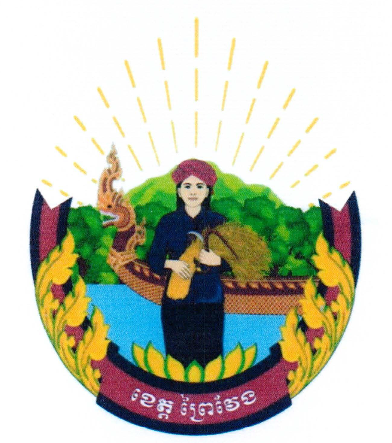
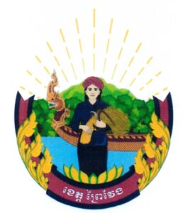
The provincial symbol is decaled by Ministry of Interior via a Prakas No.6638 BrK dated 31 October 2018 on the Establishment of Prey Veng Province Symbol. The provincial symbol consists of: the image of a female holding bunch of a sheaf of rice and sickle, A Naga racing canoe, a mountain and forest, water surface, the ribbon (blue and red), the letter of Prey Veng.
Accessibility
- Road: Prey Veng is well-connected by road to other major cities in Cambodia, including the capital, Phnom Penh and others. The National Road No. 1, 8 and 11 are the major highway passing through the province. These roads are the major transportation route for goods and people.
- Waterway: Prey Veng can access by river cruise from Phnom Penh via Lower Mekong River.
Tourism Products
The tourism industry in Prey Veng Province is relatively underdeveloped compared to Cambodia’s more famous tourist destinations like Siem Reap (home to Angkor Wat) and Phnom Penh. However, the province has potential for growth, particularly in the areas of eco-tourism, cultural tourism, and rural experiences. Here are some key aspects of the tourism industry in Prey Veng:
Ba Phnom Resort or Phnom Chher Kach Resort (រមណីយដ្ឋានបាភ្នំ) is a historical and cultural site located on the top of Chher Kach mountain, about 45 km from downtown and about 80 km from Phnom Penh (travel about 72 kilometers via National Road 1 cross the Tsubasa Bridge then left about 10 kilometers). People can climb up the cement stairway with a Naga handrail and see the rocky mountain and wildlife. There are huge rocks, and a very beautiful pagoda sitting on the peak of the mountain, which is a holy shrine and well-protected by local people, particularly elderly people. Visitors will see two different views on this mountain in the rainy and dry seasons – either lush, green fields and vegetations, or grey and golden fields. It is located in Rung Damrei village, Cheung Phnum commune of Ba Phnum district។
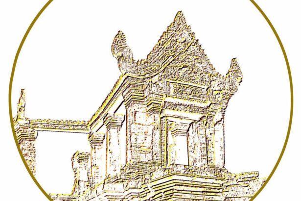
Vihear Chan Temple (ប្រាសាទវិហារច័ន្ទ): Located in Rung Damrei village, Cheung Phnum commune of Ba Phnum district, it is an ancient temple that was built during the pre- Angkorian era. The entire temple was made of lava stone for the main building and sandstone for the door frame and carving gallery. The temple has been badly damaged by age, natural and human causes. Today, it is well protected by local people and authorities and regarded as a local shrine. Some documents claimed that it was built in the Angkor era and dedicated to Brahmanism. The construction of Preah Vihear Chan Temple is as the same style as Angkor Wat’s construction. This ancient temple is now under a thorough conservation involving rangers and daily cleaning. Moreover, this temple has also been added to the national heritage list.
Prey Derm Srok or Chong Srok or Bror Theat Temple (ប្រាសាទចុងស្រុក ឬព្រៃដើមស្រុក ឬប្រធាតុ) is an ancient temple that was made of brick and sandstone in the 7th century, during the pre-Angkorian era, and is dedicated to Buddhism. There are five ponds, a big Banyan tree and a lush forest that surround the temple, providing cool shade to the temple and tourists. Most visitors come here to worship and pray for happiness. It is located in Boeng Choar village, Prey Tueng commune, Sithor Kandal district, about 38 kilometers from Downtwon Prey Veng.
Toul Baray Andet or Baray Andet (ទួលបារាយណ៍អណ្តែត): Located in Sangkat Kampong Leav of Prey Veng City, it is located about 3 km from downtown, and is easily accessible. Toul Baray Andet looks like an island as it is flooded, and the area is large enough to celebrate or practice religious activities or festivals under the cooling shade of the trees. Local people regard Toul Baray Andet as a holy shrine, and it is well protected, clean, and home to many monkeys. Tuol Baray Andet is a place of worship where local people have a strong belief that it is a sacred place, such as swearing or praying.
Chong Porm Spot (ចុងប៉ម) – The most beautiful place to watch the sunset: Located in Pir village, Sangkat Kampong Leav of Prey Veng city, it is a manmade gathering point of the rivebank area. Prey Veng, although lack of tourist attractions, but this spot is a most scenic place to see the sunset, called Chong Porm. Accompanied by the sunset view during the flooded season, this place is not inferior to others sunset spots of the country, where the local people of all ages always come here to breathe in the fresh air and relax after works and schools. In the dry season, they still breathe in the fresh-cool air with the scenery of rice field instead of the water surface in the rainy season. Local people regard Chong Porm as a place for gathering during special occasions and to have fun, including activities such as racing boats and creating illuminated floats at nighttime.
Poantaley Hill Bird Nest Watching Post (កន្លែងមើលបក្សីទួលអភិរក្សព្រៃព័ន្ធតាឡី បឹងស្នេហ៍) is located in the Ba Phnom District and is about 16 km from Prey Veng downtown. It sits in the Boeung Sneh lake, which is a wetland zone. In December 2019, it was designated a protected area (PA) by the Ministry of Environment. It is a bird sanctuary and a shelter of rare species with different kinds of endangered birds. There are about two million birds here. This area is about 100 hectares. The Environment Ministry and the Provincial Authorities planned to make it a preservation area at the end of 2019. It is easy to find boats for round-trip visits that can fit 5-7 people. The view in the evening as the birds fly back home is stupendous. These birds are migratory animals such as cranes (ក្រៀលខ្យង), (ទុង), Herons (ក្រសារ), egrets (កុក), black cormorant (ក្អែកទឹក). Visitors can visit the animals from July to November, but between September and October is the most abundant time for all kinds of animals. November is rich in egret (កុក).
Prey Veng has a diverse array of tourism service providers that cater to the needs of visitors, offering everything from guided tours and transportation to accommodation and dining. Below is an overview of the main types of tourism service providers in the province:
Accommodation: The province’s tourism infrastructure is still developing, with accommodations ranging from basic guesthouses to more comfortable hotels. The relatively low level of tourist traffic makes Prey Veng an excellent destination for travelers seeking an off-the-beaten-path experience. As of 2024, there are 5 places of hotels (equally 109 rooms) and Guesthouse is 109 places (equally 1,054 rooms).
Restaurants and Eateries: Local Restaurants and Cafés offer a variety of International and Cambodian dishes, from normal appetizer to fine dining service. Moreover, Street Food offers an authentic way to experience local cuisine, with vendors selling snacks and meals at markets and along the streets.
Transportation Services: Local transportation options, including auto-rickshaw and manual-rickshaw and Moto-taxis, public bus are common and affordable modes of transport for short distances and local travel. Moreover, Car and Bike Rentals are also available for those who prefer to explore the city at their own pace. Additionally, regular bus and mini-bus services connect to provinces from Phnom Penh and nearby provinces.
Other activities:
- Local Festivals: Traditional festivals, particularly those related to Buddhism, such as Pchum Ben (Ancestor’s Day) and Khmer New Year, are opportunities for cultural tourism. Tourists can observe or participate in these celebrations in local temples and villages.
- Agricultural Tourism: Given Prey Veng’s vast rice paddies and farming communities, there is potential for the development of agricultural tourism. Visitors can explore rice farming techniques, traditional livelihoods, and village life, which offer an authentic experience of Cambodian rural culture.
- Eco-Tourism: The province’s wetlands, rivers, and natural landscapes create opportunities for eco-tourism. Activities like bird watching, boating, and exploring the rural environment have potential, though these activities are not yet fully developed or promoted.
- Pagodas and Temples: Prey Veng has several ancient and modern Buddhist pagodas (about 539 pagodas) that attract local pilgrims and visitors interested in Cambodian religious and cultural heritage. While not on the same scale as Cambodia’s iconic temple complexes, these sites offer a quieter, more intimate experience of Cambodian spirituality.
Gallery

