Siem Reap Province
Siem Reap is one of the northwestern provinces of Cambodia which is 314 kilometers from Phnom Penh along National Road 6. Siem Reap, covering 10,299 square kilometers, is on the flat plain of Tonle Sap lake. Its neighboring provinces are (from north clockwise) Oddar Meanchey, Preah Vihear, Kampong Thom, Tonle Sap Lake (The Great lake), Battambang, and Banteay Meanchey.
Siem Reap is divided into 11 administrative districts and 2 municipalities, Siem Reap City and Run Ta Ek city. With over 1,000,000 people, the province is Cambodia’s tenth largest area and fourth most populous. Siem Reap is a significant province historically, where many historical structures, artifacts, and prehistoric settlements have been discovered.
History
Known as Angkor during much of its history, Siem Reap probably dates to prehistoric times. Siem Reap literally means “Siam defeated”, a reminder to commemorate the victory of the centuries-old conflict between the Siamese and the Khmer in the 16th century. Siem Reap is homed to the several former capital cities of the Khmer Empire dating back from the early 9th century to the 15th century such as Mahendraparvata (presently the area of Phnom Kulen National Park), Hariharalaya (present-day the modern small town called Rolous), Yasodharapura (Angkor/Norkor Wat), and Nokor Thom (Angkor Thom).
Over centuries of internal conflicts and foreign invasions, Siem Reap with other northwestern provinces once again came under the control of Siam in 1795. Nearly 70 years, in 1863, Cambodia under the reign of King Norodom sought protection from Siam by French rule. Since then, there were a few treaties being made between Siam and France on suzerainty over Cambodia territory. Until 1907 (23 March 1907), Siem Reap (Siemmarat and Nakhon Wat), Sisophon (Banteay Meanchey), and Battambang (Phra Tabong) were ceded back to Cambodia by a border treaty between France and Siam for the exchange of Trat and Dan Sai. In the same year, this returned inner Cambodia province was split into Battambang and Siem Reap by the Royal Decree of King Sisowat on 23 December 1907, according to the historical research mission of Siem Reap led by His Excellency Dr. Sorn Samnang, Advisor to the Government of Cambodia, chaired a workshop on 08 December 2017. The workshop also mentioned the sequence of events about the reforming of the assignation of the governor, the development of provincial administrative structure, the establishment of local police, the creation of a Cadastral to collect land tax, and more.
Nearly 30 years after the 1907 treaty, the above inner Cambodia province turned into part of a disputed territory between France and Thailand (formerly Siam) which resulted in the Franco-Thai War in 1941. As a result, Thailand won the war and France ceded the following provinces from Cambodia to Thailand which were labeled Thai provinces called Phra Tabong province (presently Battambang and Pailin), Phibunsongram province (presently part of Siem Reap, Banteay Meanchey, Oddar Meanchey), and Nakhon Champassak province (presently Preah Vihear province of Cambodia and Champassak province of Laos). After the end of World War II under French and UN international pressure, the Cambodian provinces again reverted to their motherland in 1946 under the conclusion of the Franco-Siamese Treaty of 1946.
There were 7 Governors of Siem Reap Province from 1992-Present, including:
- Mr. Benny Widyono (UNTAC) 1992-1993
- H.E. Tun Chay (ឯកឧត្តម ទន់ ចាយ) 1994-1999
- H.E. Chap Nalivuth (ឯកឧត្តម ចាប ណាលីវុធ) 1999-2004
- H.E. Sim Son (ឯកឧត្តម ស៊ីម សុន) 2004-2006
- H.E. Sou Phirin (ឯកឧត្តម ស៊ូ ភិរិន្ទ) 2006-2013
- H.E. Khim Bunsong (ឯកឧត្តម ឃឹម ប៊ុនសុង) 2013-2018
- H.E. Tea Seiha (ឯកឧត្តម ទៀ សីហា) 2018-2023
- H.E. Prak Saophoan (ឯកឧត្តម ប្រាក់ សោភ័ណ) 2023-Present
Geography
Siem Reap is on the north side of the Tonle Sap basin, where it shared about 82 kilometers of its border with Chi Kraeng District, Suotr Nikom District, Prasat Bakong District, Siem Reap City, Puok District, and Kralanh District.
The area of the province is divided into three parts: upper, central, and lower. The upper area is a mixed forest area and hills, with the Dangrek Mountain Plateau. The center is a plain area that consists of rice filed, residential areas, and temples. The lower area consists of alluvial flood plains of the Tonle Sap basin. Siem Reap geography in general has a rural character.
About 70% of the population lives in rural areas far from cities, relying on agriculture and non-timber forest products as a profession. About 18% of the population lives in the Tonle Sap Lake area based on fishing and other seasonal farming activities, and another 12% live in towns and cities with trade, tourism, and government employees.
Administrative divisions
As of 2020, the province is divided into 2 municipalities (Krong) and 11 districts (Srok), 14 Sangkat and 86 communes (Khum), and 910 villages. Siem Reap municipality is the seat of government, commonly known as Krong Siem Reap or Siem Reap City.
- Siem Reap Municipality (12 Sangkat)
- Run Ta Ek Techo Sen Municipality (2 Sangkat)
- Angkor Chum District (7 Khum)
- Angkor Thom District (4 Khum)
- Banteay Srei District (5 Khum)
- Chi Kraeng District (12 Khum)
- Kralanh District (10 Khum)
- Puok District (14 Khum)
- Prasat Bakong District (8 Khum)
- Soutr Nikom District (10 Khum)
- Srei Snam District (6 Khum)
- Svay Leu District (5 Khum)
- Varin District (5 Khum)
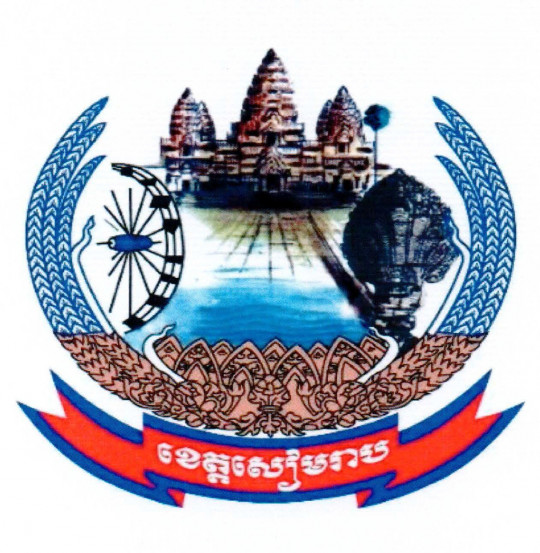
The provincial symbol consists of the image of Angkor Wat Temple, the Statue of a Naga, the image of the Palm Tree, the rice husk, and A waterwheel.
Accessibility
- Air: Siem Reap-Angkor International Airport (SAI) is about 50 kilometers from the east of Siem Reap City.
- Road: The main road through Siem Reap is National Road 6, which starts in Phnom Penh. Travelers can access the province via National Road 5 as well.
- Waterway: Siem Reap used to have many piers that can be boarded by river cruise from Phnom Penh via Tonle Sap river and Tonle Sap lake.
Local Dishes
Siem Reap has many renowned dishes such as:
- Hamok
- Preah Dak Rice Noodle
- Siem Reap grilled chicken served with several kinds of sauces/pastes like minced Prahok Angkrorng pasted (fermented fish mixed with giant red ant, chili, and spices), ground black pepper and lime sauce, and more.
- Ansom Toek Kroeung (Pork Rice Cake with a dipping sauce made from a blend of herbs, spices, fish, and Prohok)
- Samlar Macho Koun Trei Siem Reap (Siem Reap Fish Sour Soup)
Tourism
Today, Siem Reap is known worldwide as the location of the famous Angkor Wat temple and home to a UNESCO World Heritage Site namely Angkor. This province is an important tourist destination in Cambodia because it has many famous temples of Angkor Wat and many other ancient temples such as Bayon, Phnom Bakheng, Baksey Chamkrong, Baphuon, Phiman Akas, Banteay Srei, Ta Prohm, and hundreds of other temples. Being a major destination for tourists and travelers worldwide, Siem Reap is also home to natural protected areas like Phnom Kulen National Park (the UNESCO tentative site) and shares a unique ecological phenomenon of Tonle Sal Biosphere Reserve (a UNESCO Biosphere Reserve).


