Kandal is a province of Cambodia located in the southeastern part of the country, covering the area of 3,211.46 square kilometers. It completely surrounds the Phnom Penh Capital and borders the provinces of Kampong Chhnang and Kampong Cham to the north, Prey Veng to the west, shares an international border with Vietnam to the south, and borders Kampong Speu and Takéo to the west.
Kandal province is the name of a province in the administrative structure of Cambodia today, but it is not known what the history and origin of this name. According to the Document of the great Khmer man, in the reign of King Norodom (1860-1904) and the reign of King Sisowath (1904-1927), the Kingdom of Cambodia is divided into many provinces, but there is no name of Kandal Province. At that time, the names of some provinces were the names of districts today such as L’vea Em district, S’ang district, Koh Thom district, Kandal Stung district, etc.
Present day, Kandal province is divided into 11 districts and 3 municipalities, and the provincial capital is Takhmao municipality, about 10 kilometers south of Phnom Penh. With a population of over 1.3 million people, the province is ranked Cambodia’s 19th in land area and 2nd most populous. And this province also has an area of 3,568 square kilometers. The province has two international checkpoints, the Kaam Samnar checkpoint and Chrey Thom checkpoint, and the other two regional checkpoints, the Prek Chrey-Prek Ponlea gate and Prek Sbov gate.
Kandal province has shown a lot of potential, such as agriculture, industry and tourism, which are the main sectors in the province’s economic development, making Kandal is one of the richest provinces in the country. As for the infrastructure system in Kandal province, there are many major national roads to connect to other provinces. Kandal province also has major bridges across the river and will have an international airport called Techo – Ta Khmao International Airport.
History
Kandal Province, located in the southeastern part of Cambodia, has a rich history that reflects the broader historical and cultural development of the region. Here are some key points about its history:
Pre-History or Early History Period
Kandal has a long history of human settlement, with evidence suggesting it was an important area during the Funan (1st century to 550 A.D.) and Chenla periods (6th century to 802 A.D.). Kandal Province was also part of the larger Khmer Empire, which thrived from the 9th to the 15th centuries. The region was influenced by the culture, religion, and architecture of the empire. Many temples and other historical structures from this period can be found in and around Kandal. Due to its proximity to the Mekong River and Tonle Sap Lake, Kandal has historically been a significant trading hub. The river systems facilitated trade and communication, contributing to the region’s economic and cultural development.
Post-Angkor Period
The post-Angkor period of Cambodia, also called the Middle Period, refers to the historical era from the early 15th century to 1863, the beginning of the French Protectorate of Cambodia. There are several historical events that happened within many areas of present day Kandal. During Lveam Aem era (1603-1620), Lvea Aem was the royal capital to the King Chey Chetta II. Then, he moved the royal capital to Oudong in 1620 after his administrative travel to area of O’ Krong Leay of Samroung Tong province. He named his new royal capital as Preah Borom Reach Vaing Mor Ha Norkor Oudong-Mean Chey Borey Rom Odom Reacc Nives Sanak Tharn or shortly as Krong Oudong Mean Chey. He built his palace in area of Kampong Luong on the bank of river. During his reign in 1620, he established ties with The Dutch East India Company and they also built an outpost at Kampong Luong, a riverside port near Oudong.
During Oudong era, there were two historical events happened in Cambodia such as the Invasion of lower Cambodia land (Mekong Delta Territory) from Vietnam and the Siam-Vietnam power in Cambodia. Besides, Cambodia continued economically noteworthy in the early part of Oudong period. In the 17th century, the Japanese considered Cambodia to be a more important maritime power than Siam.
Colonial Period
Cambodia, including Kandal Province, came under French colonial rule in the 19th century. The French influence led to changes in administration, infrastructure development, and the introduction of new economic activities. Kandal, being close to Phnom Penh, was significantly impacted by these changes. During this period, plantations and other agricultural activities were expanded, altering the local economy and social structures. According to the inscriptions at King Ang Duong stupa and many other ancient stupas on Phnom Preah Reach Troib, Ponhea Leu district, we understand that in the reign of King Norodom Sisowath Phnom Reach Troib was in Samrong Tong district (the name of a district of Kampong Speu province today). But later, during the reign of King Sisowath-Monivong (1927-1941), the provincial border was re-established, and only then Phnom Preah Reach Troib was re-located in Kandal Province (Inscription of Preah Sisowath Stupa). Therefore, we can conclude that Kandal province has been part of the administrative structure since the reign of King Sisowath Monivong during the French colonial rule. Kandal Province during the reign of King Sisowath Monivong (1927-1941) was divided into 12 districts and regions, including 10 districts and 2 regions:
- Chao Vai Khet “ចៅហ្វាយខេត្ត” (Provincial Governor): Oknha Reachea Metrey Serei M’Chhem Kreas Setha Varaa Rak Sethisak Udomkrampahu “ឧកញ៉ារាជាមេត្រីសិរីមជ្ឈឹមគ្រាស សេដ្ឋវរារក្សសិទ្ធិស័ក្តិឧត្ដមក្រមពាហុ”
- Phu Chuy Khet “ភូឈួយខេត្ត” (Vice Provincial Governor): Chumnith Metrei “ជំនិតមេត្រី”, Pbiphoat Metrei “ពិភ័តមេត្រី”
- Ballat Khet “បាឡាត់ខេត្ត”: Kiri Rotha “គិរិរដ្ឋា”
- Chao Vai Srok Phnom Penh “ចៅហ្វាយស្រុកភ្នំពេញ” (Governor of Phnom Penh District): Bamrong Reachea “បំរុងរាជា”
- Ballat Srok Phnom Penh “បាឡាត់ស្រុកភ្នំពេញ” (Ballat of Phnom Penh District): Pbiphoat Reachea Sangkream “ពភ័ត្តរាជាសង្រ្គាម”
- Chao Dambon Thnol TorToeung “ចៅតំបន់ថ្នល់ទទឹង” (Governor of Thnol Tor Toeung Region): Chumnith Phu Thor “ជំនិតភូធរ”
- Chao Vai Srok Ponhea Loeur “ចៅហ្វាយស្រុកពញាឮ” (Governor of Ponhea Loeur District): Utey Sena “ឧទ័យសេនា”
- Chao Vai Srok Khsarch Kandal “ចៅហ្វាយស្រុកខ្សាច់កណ្តាល” (Governor of Khsarch Kandal District): Sena Metrei “សេនាមេត្រី”
- Ballat Srok Khsarch Kandal “បាឡាត់ស្រុកខ្សាច់កណ្តាល” (Ballat of Khsarch Kandal District): Metrei Sena “មេត្រីសេនា”
- Chao Vai Srok Muk Kampoul “ចៅហ្វាយស្រុកមុខកំពូល” (Governor of Muk Kampoul District): Chul’Sa Phimuk “ជលសាភិមុខ”
- Chao Vai Srok Vihear Sour “ចៅហ្វាយស្រុកវិហារសួរគ៌” (Governor of Vihear Sour District): Sourkea Nurak “សួគ៌ានុរក្ស”
- Chao Vai Srok Kien Svay “ចៅហ្វាយស្រុកកៀនស្វាយ” (Governor of Kien Svay District): Metrei Phuthor “មេត្រីភូធរ”
- Ballat Srok Kien Svay “បាឡាត់ស្រុកកៀនស្វាយ” (Ballat of Kien Svay District): Pbiphoat Phuthor “ពិភ័ត្តិភូធរ”
- Chao Vai Srok Lvea Em “ចៅហ្វាយស្រុកល្វាឯម” (Governor of Lvea Em District): Ei So Metrei “ឥសូរមេត្រី”
- Ballat Srok Lvea Em “បាឡាត់ស្រុកល្វាឯម” (Ballat of Lvea Em District): Anurak Metrei “អនុរក្សមេត្រី”
- Chao Vai Srok Kandal Stung “ចៅហ្វាយស្រុកកណ្តាលស្ទឹង” (Governor of Kandal StungDistrict): Vongsa Phuthor “វង្សាភូធរ”
- Ballat Srok Kandal Stung “បាឡាត់ស្រុកកណ្តាលស្ទឹង” (Ballat of Kandal Stung District): Phuthor Pbiphoat “ភូធរពិភ័ត្តិ”
- Chao Vai Srok Lerk Dek “ចៅហ្វាយស្រុកលើកដែក” (Governor of Lerk Dek District): Inthor Vichey Techo “ឥទ្ធរវិជ័យតេជោ”
- Ballat Srok Lerk Dek “បាឡាត់ស្រុកលើកដែក” (Ballat of Lerk Dek District): Pichey Techo “ពិជ័យតេជោ”
- Chao Dambon Lerk Dek “ចៅតំបន់លើកដែក” (Governor of Lerk Dek Region): Techo Nurak “តេជោនុរក្ស”
- Chao Vai Srok S’aang “ចៅហ្វាយស្រុកស្អាង” (Governor of S’aang District): Vongsa Metrei “វង្សាមេត្រី”
- Chao Vai Srok Koh Thom “ចៅហ្វាយស្រុកកោះធំ” (Governor of Koh Thom District): Pheakdey Techo “ភក្តីតេជោ”
Later on, in 1947, the Royal Kram established seven administrative zones:
- The first administrative zone: Battambang and Siem Reap provinces.
- The second administrative zone: Pursat and Kampong Chhnang provinces.
- The third administrative zone: Kampong Thom and Kampong Cham provinces.
- The fourth administrative zone: Kratié and Stueng Treng provinces.
- The fifth administrative zone: Prey Veng and Svay Rieng provinces.
- The sixth administrative zone: Kandal and Kampong Speu provinces.
- The seventh administrative zone: Takéo and Kampot provinces.
Independence and Conflict Period
Cambodia gained independence from France in 1953. The subsequent decades saw political turmoil, including the Cambodian Civil War and the Khmer Rouge regime’s rise to power in the 1970s. Kandal Province, like much of Cambodia, suffered greatly during this period, with significant loss of life and destruction.
After the fall of the Khmer Rouge in 1979, Cambodia began the long process of reconstruction. Kandal Province played a role in the country’s recovery, contributing to agricultural production and other economic activities.
Modern Day
Today, Kandal Province is one of Cambodia’s most important economic regions, benefiting from its location near Phnom Penh. It is a center for agriculture, industry, and trade. The province’s economy is diverse, with significant contributions from rice farming, fishing, and manufacturing. Moreover, Kandal continues to preserve its rich cultural heritage. Temples, traditional festivals, and local customs reflect the historical and cultural evolution of the region. Kandal Province’s history is intertwined with Cambodia’s broader historical narratives, reflecting periods of prosperity, colonial influence, conflict, and recovery. Its strategic location and cultural heritage continue to shape its role in contemporary Cambodia.
Dignitaries who were former governors of Kandal since 1993
There were 08 Governors of Kandal Province from 1993-Present, including:
- H.E. Chok Sarik (ឯកឧត្តម ចក់ សារិក) 1993 – 1999
- H.E. Tep Nunry (ឯកឧត្តម ទេព នន្នរី) 1999 – 2003
- H.E. Khem Bou (ឯកឧត្តម ឃឹម បូរ) 2003 – 2007
- H.E. Chhun Sirun (ឯកឧត្តម ឈុន ស៊ីរុន) 2007 – 2013
- H.E. Phai Bunchhoeun (ឯកឧត្តម ផៃ ប៊ុនឈឿន) 2013 – 2014
- H.E. Mao Phirun (ឯកឧត្តម ម៉ៅ ភិរុណ) 2014 – 2020
- H.E. Kong Sophoan (ឯកឧត្តម គង់ សោភណ្ឌ) 2020 – 2024
- H.E. Kouch Chamroeun (ឯកឧត្តម គួច ចំរើន) 2024 – Present
Geography
Kandal Province is centrally located in Cambodia, surrounding the capital city of Phnom Penh. Its geography is characterized by a mix of river systems, floodplains, and agricultural land, making it an important region for the country’s economy and transportation. Here are some key geographical features of Kandal Province:
Topography: Much of Kandal Province consists of low-lying floodplains, which are highly fertile and suitable for rice cultivation. These floodplains are periodically inundated during the rainy season, enriching the soil with nutrients. While the province is predominantly flat, there are a few notable hills, such as Oudong Mountain (Phnom Oudong) and Phnom Prasith, which offer elevated terrain and scenic views of the surrounding landscape.
Water Bodies: There are three rivers flow across the Kandal province. The Mekong River flows through Kandal Province, providing crucial water resources for agriculture, fishing, and transportation. The river is a lifeline for the region, supporting both local livelihoods and biodiversity. Tonle Sap River also runs through the province, connecting the Tonle Sap Lake to the Mekong River. The Tonle Sap River is known for its unique flow reversal during the monsoon season, which significantly impacts the region’s hydrology and agriculture. A distributary of the Mekong River, the Bassac River splits off from the main river and flows southward, contributing to the province’s rich alluvial soil.
Climate: The province experiences a tropical monsoon climate, characterized by a distinct wet season (May to October) and dry season (November to April). The wet season brings heavy rainfall, essential for agriculture, while the dry season is typically cooler and less humid.
Natural Resources, Vegetation and Land Use: The province’s fertile floodplains are extensively used for agriculture, with rice paddies being the dominant crop. Other crops include maize, sugarcane, and various vegetables. Moreover, the rivers and floodplains support significant fishing activities, providing a vital source of food and income for local communities. While much of the province is cultivated, there are areas of natural vegetation, particularly along the riverbanks and in less accessible regions.
Kandal Province’s geography, with its rich river systems, fertile floodplains, and strategic location, plays a crucial role in its economic activities, particularly in agriculture and trade. The province’s natural and cultural resources also make it an attractive destination for tourism.
Administrative divisions
As of 2024, the province is divided into 3 municipalities (Krong) and 10 districts (Srok), 26 Sangkat and 101 communes (Khum), and 1005 villages. Ta Khmao municipality is the seat of government, commonly known Krong Ta Khmao or Ta Khmao City.
- Ta Khmao Municipality (10 Sangkat)
- Akeiy Ksatr Municipality (11 Sangkat)
- Sampov Puon Municipality (05 Sangkat)
- Kandal Stueng District (18 Khum)
- Kien Svay District (08 Khum)
- Khsacg Kandal District (12 Khum)
- Koh Thom District (06 Khum)
- Leuk Daek District (07 Khum)
- L’vea Aem District (10 Khum)
- Mukh Kampul District (07 Khum)
- Ang Snuol District (10 Khum)
- Ponhea Lueu District (11 Khum)
- S’ang District (12 Khum)
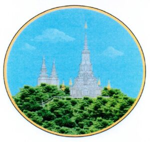
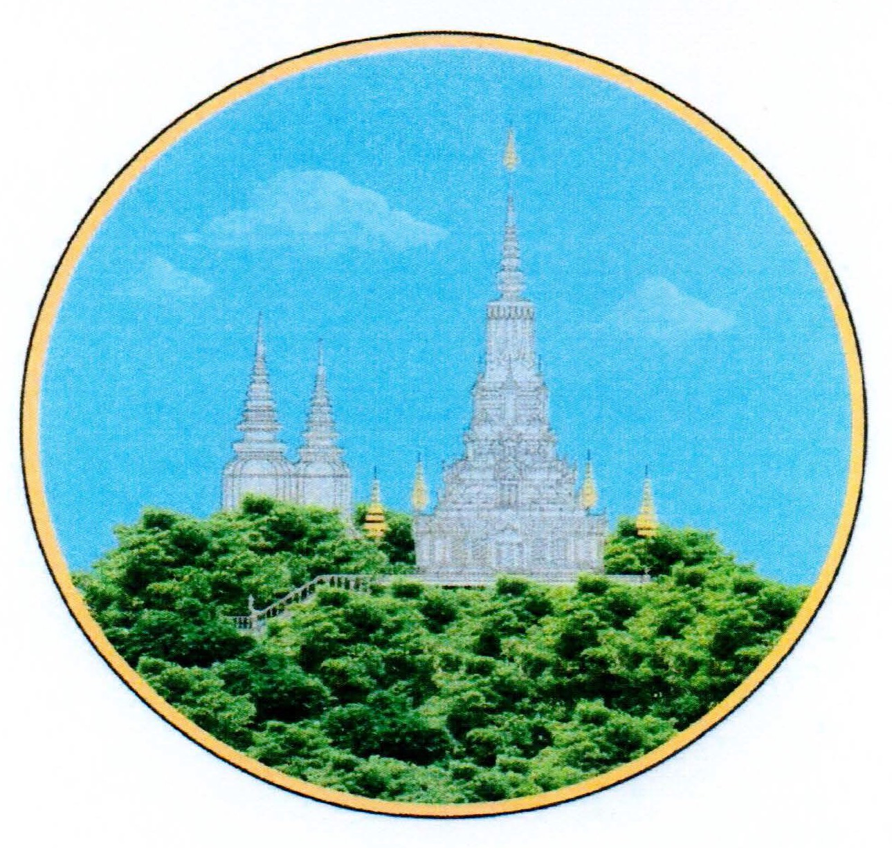
The provincial symbol is decaled by Ministry of Interior via a Prakas No.8863 BrK dated 19 September 2019 on the Establishment of Kandal Province Symbol. The symbol has shape and image as follow:
- Rounded shape
- Surrounding golden circle represents the territory of Kandal province that surrounds Phnom Penh
- The three great stupas represent the Nation, Religion, King and represent the three powers of the state including the legislature, the executive and the judiciary.
- Preah Shakyamuni Chedei (Stupa) represents a place enshrined the Buddha’s relics, a sacred place of the Cambodian people to worship Buddhism.
- Top of Stupa represents the civilization and nobility of the Cambodian nation since ancient times
- Fancy design represents civilization, progress, socio-economic development and the transformation of rural lands into cities
- Royal seven-tiered umbrella represents the 7 days of the week and January 7 Victory Day
- Phnom Preah Reach Troap represents the Territorial and Territorial Administration of Kandal Province
- Green trees represent a good environment, rich in natural resources, all kinds of plants and the growth of agriculture.
- Cloud represents the prosperity and harmony of the Cambodian people living under the roof of peace in the territory of the Kingdom of Cambodia.
Accessibility
- Road: The main road from Phnom Penh to Takhmav town is about 11 kilometers. Moreover, there are several Provincial National Road such as NR1, NR2, NR3, NR4, NR5, NR6, NR8, NR21, NR21A, NR21B, NR41, NR42, NR51, NR61.
- Railway: There is a railway link (Southern Line: Phnom Penh – Takéo, Kep, Kampot, and Preah Shinanouk and Northern Line: Phnom Penh – Pursat and Battambang) pass through the province around 18.31 kilometers.
- Waterway: Kandal can access by river cruise via Upper Mekong River, Lower Mekong River, Tonle Sap River and Bassac River. Moreover, there are several riverports located in this province. And, one of the most important is Phnom Penh Autonomous Port.
- Airway: Techo – Ta Khmao International Airport.
Tourism Products
Kandal Province offers a variety of tourist attractions that showcase its rich history, culture, and natural beauty. Here are some notable ones:
Oudong Mountain (Phnom Oudong ភ្នំឧដុង្គ): it is a natural, historical, and religious site and was the former royal capital of Cambodia until the mid-19th century. The area features several stupas and temples, including the notable Preah Reach Damrei Sam Poan stupa, where offers panoramic views of the surrounding countryside and a glimpse into Cambodia’s royal past.
Angkor Chey Pagoda (វត្តអង្គរជ័យ): Angkor Chey Pagoda is a monument located next to a stream. There are a lot of buildings at this site. Many people believe this site is sacred and come for blessings and praying. There is a fishpond with water lilies, and thatch stalls in the middle of the pond where tourists come to feed the fish after they visit pagoda. There is a new temple with 5 towers and a very pleasing architectural style. it is a significant religious site with beautiful architecture and serene surroundings. Known for its large reclining Buddha statue and numerous other Buddha images.
Koh Dach (Silk Island): it is located on the Mekong River, accessible by ferry from Phnom Penh. It is known for its traditional silk weaving villages where visitors can watch artisans at work and purchase handmade silk products. Moreover, it offers a peaceful retreat with a glimpse into local village life.
Phnom Reap (ភ្នំរាប): Reap Mountain is a cultural and religious attraction site where there are many religious buildings, including Buddha statues. It also has many trees which provide a cool shade and is worth seeing. There are three towers of temples that are very high.
The tourism industry in Kandal has grown significantly over the years, transforming the province into a popular destination for both domestic and international travelers. Here’s an overview of the key aspects of Kandal’s tourism industry:
Accommodation: Kandal Province has some local guesthouses and hotels, many tourists stay in Phnom Penh and take day trips to Kandal due to its close proximity. Kandal offers a variety of accommodation options, including budget guesthouses, mid-range hotels, boutique hotels, and luxury resorts. The growth of eco-friendly lodges and homestays has also been notable, catering to environmentally conscious travelers.
Restaurant and Eatery Services: There are 62 restaurants and eateries, where local restaurants and eateries serve traditional Khmer cuisine, including dishes like Seafood dishes etc.; International restaurants offer a variety of cuisines including Western and Asian cuisine. Moreover, Cafés and Coffee Shops are popular spots for relaxing and enjoying local coffee and snacks.
Transportation Services: The province is well-connected by road, making it easy to travel by car, taxi, or motorcycle. Buses and tuk-tuks are also available for shorter trips.
Other Activities:
- Local Markets: Kandal Market and Ta Khmao Market are bustling local markets where visitors can experience local food, crafts, and daily life. It is a great place to interact with locals and purchase unique souvenirs.
- Traditional Craft Villages: Villages specializing in traditional crafts like pottery, weaving, and basketry. Visitors can engage with local artisans, learn about their techniques, and try their hand at crafting.
- Mekong River Cruises: Boat trips along the Mekong River offer stunning natural scenery and opportunities to observe riverine life. Cruises often include visits to floating villages and local communities.
Gallery
 Kandal Province of Cambodia
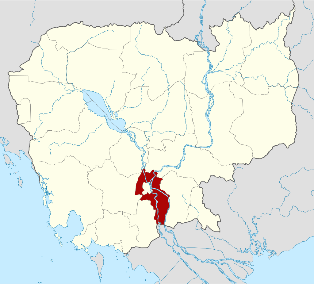 Kandal Province on Map © Kmusser
