Preah Vihear Province
Situated in the northern part of Cambodia, Preah Vihear Province is one of the 25 provincial capitals with a total area of 13,821.76 square kilometers, a distance of 298 km from Phnom Penh along National Road 6 (about 171 kilometers) and Road 62 (about 129 kilometers). It is bordered to the north by Thailand for 129 km and by Laos for 140 km in a series of mountain ranges, south to Kampong Thom, east to Stung Treng and west to Siem Reap and Oddar Meanchey.
Preah Vihear Province was established by Code No. 194-B-R on 22 July 1964, after the Kingdom of Cambodia won the case against Thailand by a judgment dated 15 June 1962 at the International Court of Justice in the Hague, Netherlands, and named Preah Vihear Province. The province at that time, there were only 4 districts: Rovieng, Chhaeb, Choam Khsaant, which was separated from Kampong Thom province and Angkor Thom district, which was separated from Siem Reap province (there were 3 communes: Anlong Veng, Thkov and Koh Ker communes). The province has a provincial town in Kampong Pranak called Phnom Tbeng Meanchey. Tbeng Meanchey is the provincial capital of the Province, established in 1982 until February 25, 2009. Tbeng Meanchey district was renamed Preah Vihear city on May 17, 2009 and the province has a river that flows through Stung Sen.
Present day, Preah Vihear is divided into 7 administrative districts and 1 municipality, Preah Vihear City. The province has one international checkpoint, the An Ses checkpoint, and one Bilateral checkpoint, Prasat Preah Vihear. With over 277,000 people (As of 2022), the province is Cambodia’s third largest area and nineteenth populous.
History
Preah Vihear Province, located in northern Cambodia, has a rich history deeply intertwined with the region's cultural and political developments. Here is an overview of its history:
Pre-History or Early History Period
The area that is now Preah Vihear Province was inhabited long before the establishment of the Khmer Empire. Archaeological evidence indicates the presence of early civilizations, including pre-Angkorian sites that show the region's strategic importance due to its proximity to the Dangrek Mountains and the natural resources in the area.
Preah Vihear Province is most renowned for the Preah Vihear Temple, a UNESCO World Heritage Site that dates back to the early 9th century. This Hindu temple, dedicated to the god Shiva, was built during the reign of several Khmer kings, including Yasovarman I and Suryavarman I. The temple served both as a place of worship and a strategic military outpost due to its commanding view of the plains below. The temple's importance grew as the Khmer Empire expanded, becoming a key religious and administrative center.
Post-Angkor Period
After the decline of the Khmer Empire in the 15th century, the region became less politically central but remained culturally significant. As the empire weakened, control of the region, including Preah Vihear, oscillated between the emerging powers of Siam (Thailand) and what remained of the Cambodian kingdom.
From the 15th century onward, Preah Vihear Province, like much of northwestern Cambodia, came under Siamese (Thai) influence and control at various times. The Siamese expanded their influence over the region, and it became a contested territory, with the temple and surrounding areas changing hands between the Siamese and the Cambodian kingdoms.
Colonial Period
In the late 19th century, Cambodia became a French protectorate as part of French Indochina. The French colonial administration sought to solidify Cambodia's borders, and in 1907, a treaty was signed with Siam that recognized the Preah Vihear area, including the temple, as part of Cambodia. This period marked the beginning of modern efforts to clearly define the borders between Cambodia and Thailand.
Independence and Conflict Period
After Cambodia gained independence from France in 1953, the status of the Preah Vihear Temple became a source of tension between Cambodia and Thailand. In 1962, the International Court of Justice (ICJ) ruled that the temple belonged to Cambodia, a decision that Thailand accepted, but the surrounding land remained disputed. In the late 20th and early 21st centuries, the border area around the Preah Vihear Temple was the site of several military skirmishes between Cambodian and Thai forces. Tensions flared up particularly in the 2000s, leading to sporadic clashes as both nations laid claim to parts of the area around the temple.
Modern Day
The situation became more internationally recognized when Preah Vihear Temple was inscribed as a UNESCO World Heritage Site in 2008, under Cambodia's nomination. This move was welcomed by Cambodians but met with resistance from Thailand, further escalating tensions. However, efforts have been made in recent years to manage and reduce conflicts in the area through diplomacy and international mediation.
Preah Vihear Province is not only home to the temple but also a region rich in other archaeological sites and natural beauty, including the Dangrek Mountains and the Kulen Promtep Wildlife Sanctuary. The cultural heritage of the province plays a crucial role in the identity and pride of the Cambodian people. Despite its historical and cultural significance, Preah Vihear Province has remained relatively underdeveloped compared to other regions in Cambodia. Moreover, in recent years, there have been efforts to boost tourism, particularly to the Preah Vihear Temple, and to improve infrastructure in the province.
Preah Vihear Province is a region with a profound historical legacy that continues to shape its present-day identity and geopolitics. The province's history, marked by its significance during the Khmer Empire and subsequent territorial disputes, remains central to Cambodian national pride and cultural heritage. Today, it stands as a symbol of Cambodia's rich past and its ongoing journey towards peace and development.
Dignitaries who were former governors of Preah Vihear Province since 1979
There were 10 Governors of Preah Vihear Province from 1979-Present, including:
- H.E. Veng Khoun (ឯកឧត្តម វេង ឃួន) served as Chairman of Provincial People’s Revolutionary Committee from 1979-1981
- H.E. Nei Péna (ឯកឧត្តម នៃ ប៉េណា) served as Chairman of Provincial People’s Revolutionary Committee from 1981-1983
- H.E. Suk Sam Eng (ឯកឧត្តម ស៊ុក សំអេង) served as Chairman of Provincial People’s Revolutionary Committee from 1983-1985 and 1998-1994
- H.E. Oak Moni (ឯកឧត្តម អោក មុនី្ន) served as Chairman of Provincial People’s Revolutionary Committee from 1985-1988
- H.E. Mean Sarin (ឯកឧត្តម មៀន សារិន) served as Chairman of Provincial People’s Revolutionary Committee from 1994-1998
- H.E. Preap Tan (ឯកឧត្តម ព្រាប តាន់) served as Provincial Governor from 1999-2009
- H.E. Um Mara (ឯកឧត្តម អ៊ុំ ម៉ារ៉ា) served as Provincial Governor from 2009-2016
- H.E. Un Chanda (ឯកឧត្តម អ៊ុន ចាន់ដា) served as Provincial Governor from 2016-2019
- H.E. Prak Sovan (ឯកឧត្តម ប្រាក់ សុវណ្ណ) served as Provincial Governor from 2019-2022
- H.E. Kim Rithy (ឯកឧត្តម គីម រិទ្ធី) served as Provincial Governor from 2022-Present
Geography
Preah Vihear Province, located in northern Cambodia, is characterized by a diverse and significant geographical landscape. Its geography plays a key role in its historical, cultural, and ecological significance. Here is an overview of the province's geography:
Topography: The most prominent geographical feature in Preah Vihear Province is the Dangrek Mountain Range, which runs along the northern border with Thailand. These mountains create a natural boundary and are home to the famous Preah Vihear Temple, perched on a cliff at an elevation of about 525 meters (1,722 feet) above sea level. The Dangrek Mountains are a significant geographical barrier, separating the Cambodian plains from the Thai plateau. Much of the province consists of flat to gently rolling plains, which are part of the larger central plains of Cambodia. These plains are primarily used for agriculture, including rice cultivation, which is the mainstay of the local economy. The province's fertile plains support a variety of agricultural activities, with rice being the dominant crop. Other crops include cassava, maize, and various fruits and vegetables. The availability of arable land and water resources supports the livelihoods of the majority of the population.
Water bodies: The province is traversed by several rivers, including tributaries of the Mekong River, which flows to the east of the province via Kampong Srorlav I and Kampong Srorlav II communes of Chheab district. Stung Sen River origins from Choam Khsaant district around 213 kilometers. These rivers play a crucial role in irrigation and are vital for the agricultural activities in the region.
Climate: The Province experiences a tropical monsoon climate, characterized by a distinct wet and dry season. The wet season, from May to October, brings heavy rainfall, while the dry season, from November to April, is marked by lower humidity and less precipitation. The province generally has warm temperatures year-round, with average temperatures ranging from 25°C to 30°C (77°F to 86°F). The coolest months are typically December and January, while April is usually the hottest month.
Natural Resources, Vegetation and Land Use: The province is known for its rich forested areas, particularly in the northern and eastern parts of the province. These forests are part of the larger Indochina rainforest and are home to a variety of wildlife, including endangered species. The forests also provide resources such as timber and non-timber forest products for local communities. Kulen Promtep Wildlife Sanctuary, one of the largest protected areas in Cambodia, this sanctuary covers a significant portion of Preah Vihear Province. It is a critical habitat for a wide range of species, including elephants, leopards, and several rare bird species. The sanctuary is also important for its role in protecting the watershed and maintaining ecological balance in the region.
- Kulen Prohm Tep Wildlife Sanctuary covered land area of 428,971 hectares sharing with Siem Reap and Oddar Meanchey provinces (in which 240,273.34 hectares are in Preah Vihear Province)
- Boeng Paer Wildlife Sanctuary covered land area of 265,883 hectares sharing with Kampong Thom and Siem Reap provinces (in which 127,128.35 hectares are in Preah Vihear Province)
- Prey Lang Wildlife Sanctuary covered land area of 489,663 hectares sharing with Kratié, Kampong Thom, and Stung Treng provinces (in which 117,375.91 hectares are in Preah Vihear Province)
- Phnom Thnoat-Phnom Pok Wildlife Sanctuary covered land area of 51,730 hectares sharing with Siem Reap province (in which 32,500.44 hectares are in Preah Vihear Province)
- Chhaeb Preah Roka Wildlife Sanctuary covered land area of 347,568 hectares sharing with Kratié, Kampong Thom, and Stung Treng provinces (in which 313,977.87 hectares are in Preah Vihear Province)
- Preah Vihear-Phnom Dangrek Protected Landscape covered land area of 47,318 hectares sharing with Oddar Meanchey province (in which 25,045.97 hectares are in Preah Vihear Province)
- Bakan Protected Landscape covered land area of 2,124 hectares.
- Phnom Tbeng Natural Heritage Site covered land area of 43,391 hectares.
In summary, the geography of the Province is defined by its mountainous northern border, expansive plains, and rich natural resources. The province's diverse landscape supports both its cultural heritage and its agricultural economy, while also presenting challenges related to environmental conservation and infrastructure development.
Administrative divisions
As of 2024, the province is divided into 01 municipality (Krong) and 07 districts (Srok), 02 Sangkat and 51 communes (Khum), and 232 villages. Based on CDB of 2022, the total population is 277,464 people (female 139,228), the number of households is 66,683 households, and the density is 20 people/km2. Preah Vihear municipality is the seat of government, commonly known Krong Preah Vihear or Preah Vihear City.
- Preah Vihear Municipality (02 Sangkat)
- Chey Saen Municipality (06 Khum)
- Choam Ksant District (08 Khum)
- Chhaeb District (08 Khum)
- Kulen District (06 Khum)
- Rovieng District (12 Khum)
- Tbaeng Meanchey District (04 Khum)
- Sangkum Thmei District (05 Khum)
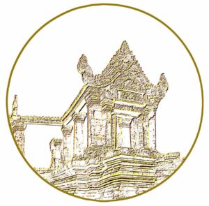
The provincial symbol is decaled by Ministry of Interior via a Prakas No.4133 BrK dated 23 October 2020 on the Establishment of Preah Vihear Province Symbol. The symbol has shape and image as follow:
- Round shape
- The Temple of Preah Vihear image represents the harmony and economic development through tourism in Preah Vihear Province. In addition, the Temple of Preah Vihear was inscribed on the UNESCO World Heritage List on July 8, 2008 and approved by the International Council on Monuments and Sites (ICOMOS) recognized as "the greatest masterpiece of Khmer architecture and universal value"
- Gold color represents the Priceless Prosperity of Cultural Property in Preah Vihear Province
- White surface represents purity, goodness, faith, religion, morality and behavior.
Accessibility
- Road Network: Preah Vihear Province has a developing road network that connects it to other parts of Cambodia, particularly Siem Reap and Kampong Thom. However, the road conditions can vary, with some areas being difficult to access during the rainy season. There is about 300 kilometers from Phnom Penh (National Road 6 about 171 kilometers and National Road 62 about 129 kilometers).
- Border Crossings: The province has a few border crossings with Thailand such An Ses International Checkpoint and Preah Vihear temple bilateral checkpoint, which are important for trade and cross-border movement. These crossings have also been points of contention during periods of territorial disputes.
Tourism Product
Preah Vihear Province, located in northern Cambodia, is rich in natural and cultural attractions, making it an increasingly popular destination for tourism. Here are some key tourism resources in Preah Vihear:
Preah Vihear Temple: The most famous attraction in the province, Preah Vihear Temple is a stunning example of Khmer architecture. Perched atop the Dangrek Mountains, it offers breathtaking views of the surrounding plains. The temple, dedicated to the Hindu god Shiva, was constructed between the 9th and 12th centuries by King Yaksovarman I (889-910), King Suryavarman I (1002-1050), King Jayavarman VI (1080-1109) and King Suryavarman II (1113-1150), and is adapted from the Banteay Srey architectural style. Located in Thomacheat Samdach Techo Hun Sen village, Srar Aem commune of Choam Ksant distict, it is known for its intricate carvings and religious significance. The temple complex was listed as UNESCO World Heritage Site on 07th July 2008.
Boeung Pe Wildlife Sanctuary (ដែនជម្រកសត្វព្រៃបឹងពេរ): This wildlife sanctuary is one of Cambodia’s most important protected areas, home to a variety of species including the critically endangered giant ibis and white-shouldered ibis. The sanctuary's wetlands and forests are vital habitats for bird species, making it a prime location for birdwatching. Boeung Pe is a developing eco-tourism destination where visitors can engage in guided wildlife tours, birdwatching expeditions, and learn about conservation efforts. The sanctuary plays a crucial role in preserving Cambodia’s unique biodiversity.
Kulen Promtep Wildlife Sanctuary (ដែនជម្រកសត្វព្រៃគូលែនព្រហ្មទេព): Largest Protected Area in Cambodia, spanning several provinces, including Preah Vihear, this sanctuary is known for its diverse ecosystems, including lowland forests, wetlands, and highlands. It is a critical habitat for many endangered species, including Asian elephants and banteng (a type of wild cattle). Visitors can explore the sanctuary through guided treks and nature walks, offering a chance to experience Cambodia’s natural beauty and learn about its wildlife conservation efforts.
Rovieng Iron Mine (Industrial Heritage): The Rovieng area is known for its historical iron mines, which were operated during the French colonial period and later by the Khmer Rouge. The site offers an interesting look at Cambodia’s industrial history and its impact on the local environment and economy. The mines provide a unique perspective on the region’s development and the hardships faced by those who worked there. Visitors interested in history and culture will find this site compelling.
Dangrek Mountains: The Dangrek Mountain Range forms the natural border between Cambodia and Thailand. It offers stunning landscapes and is home to several historical and cultural sites, including the Preah Vihear Temple. The mountains are ideal for hiking, offering various trails that lead to viewpoints, ancient ruins, and hidden caves. The area is also rich in flora and fauna, making it a great spot for nature lovers.
Phnom Tbeng Meanchey (ភ្នំត្បែងមានជ័យ): This mountain is not only a significant cultural site but also a natural landmark in the province. It is associated with local legends and spiritual practices, and its summit offers panoramic views of the surrounding landscape. Phnom Tbaeng Natural Heritage Site is a protected area which covers 25,269.41 hectares. Tbaeng Mountain has the most beautiful landscape, including Tama Waterfall, Tangyu Waterfall, Bat cave and Thmor 3-Dom (Three-Stone), which is a sacred place. The mountain is a popular spot for hiking and adventure tourism. Visitors can explore the dense forests, visit ancient pagodas, and experience the natural beauty of the area. Also, there are homestays, local food and drink services, and a tour guide service.
Preah Nimit Waterfall or Sopheakmit Waterfall (ទឹកធ្លាក់ព្រះនិមិត្ត) is a natural attraction site with beautiful scenery. This site has cascades of water from the high waterfall, flowing from the Mekong River through the cascading canyons. During the dry season, you will be able to see the rocky outcrops with low water levels and hear the sound of water flowing. The site is located in Kampong Samy Village, Kampong Sralau 2 Commune, Chep District, more than 140 km northwest of the Preah Vihear town, bordering with Laos as well as Stung Treng province. Tourists can enjoy the water and have a picnic at the nearby restaurants.
Phnom Tbeng Waterfall or Tama Waterfall (ទឹកធ្លាក់ភ្នំត្បែង ឬទឹកធ្លាក់តាម៉ា) is a natural attraction site, located of the ridge of Tbeng mountain. It stands 30m high and is surrounded by green forest. This waterfall is also an ancient holy place. Tourists can enjoy their family picnic trips and go swimming. Phnom Tbeng or Tama Waterfall is located in Beng Kong Village, Preah Khlaing Commune, Tbeng Meanchey District, Preah Vihear Province, approximately 280 km from Phnom Penh along National Road No. 62 or 100 km from the intersection of Siem Reap in Trapeang Russey commune of Kampong Thom province.
Koh Ker Temple Complex (តំបន់ប្រាសាទកោះកេរ): Koh Ker served as the capital of the Khmer Empire for a brief period in the 10th century under King Jayavarman IV. The complex is less crowded than Angkor Wat and offers a more secluded experience. It features over 180 sanctuaries, with Prasat Thom, a seven-tiered pyramid temple, being the most iconic. The site is surrounded by dense jungle, making it a great destination for adventurous travelers and photographers. The remote location also contributes to the mystical atmosphere of the ruins. The complex was listed as a UNESCO tentative world heritage in 1992 and later was listed as UNESCO World Heritage Site on 17th September 2023.
Preah Khan Kompong Svay (Prasat Bakan) “ប្រាសាទព្រះខ័នកំពង់ស្វាយ (ប្រាសាទបាកាណ)”: Locally known as Bakan Temple, this is an ancient cultural and historical site with a beautiful structure, located in Ta Saeng village, Ronak Ser commune of Sangkum Thmei district. According to documents from Ministry of Culture and Fine Arts, this lesser-known temple complex is one of the largest in Cambodia and built dates back to the mid-11th century to early 12th century, during the reign of King Suryavarman I (1002-1050 C.E.).
Tumnob 95 or 95 Dam: Located in Tumnob village, Sangkat Pal Hal of Preah Vihear twon, it is either man-made or natural attraction site. It has a lush and beautiful landscape where tourists can visit with family or friends. The rich natural scenery can help visitors feel relaxed with the fresh air here. They can also sit under the shade of a thatch stall and eat delicious food.
BeTreed Adventures is a unique ecotourism destination for the off-the-beaten-path travelers, nature seekers and adventurers, providing an ecostay in a small part of wild Cambodia. Tourists can also enjoy many experiences in this community such as trekking and experiences in the nearby caves and temples. This site is located in Tabos village, Sdau commune, Sangkum Thmei district, Preah Vihear province.
Beng Koung Waterfall (ទឹកធ្លាក់បេងកោង): Located in Beng Koung village, Preah Khlaing commune of Tbeng Mean Chey district, about 6 km from Preah Vihear Provincial Town on National Road 62, which has access through the gate of Wat Leu Phnom Tbeng, called Wat Dambok Khmao. This waterfall has two levels, where the upper level is a large pool that is accessible for bathing of all ages. While, the lower level is a bit difficult for bathing due to the mossed rocks could caused the danger if neglected. The source of water is from the Tbaeng Mountain. This place is naturally favorable with the rich in forests, waterfalls and cool weather. After walking through banana orchards, bean fields, orchards, Nipa palm fields, and large boulders, tourists can sit down to eat food, relax and take a swim here.
Chak Angrae Kraom Waterfall or Anlong Svay Waterfall (ទឹកជ្រោះចាក់អង្រែក្រោម ឬ ទឹកជ្រោះអន្លង់ស្វាយ) is a natural attraction site located at the ridge of Tbeng Mountain, Bak Kaim village, Chhean Mukh commune of Tbeng Mean Chey district in Preah Vihear Province. The waterfall is very attractive, accompanied by the beauty of nature, greenery and rock and has a height of more than 20 meters, a depth of more than 7 meters allows tourists to bathe. In addition, tourists can also pitch a tent and take beautiful pictures.
The tourism industry in Preah Vihear has grown significantly over the years, transforming the province into a popular destination for both domestic and international travelers. Here's an overview of the key aspects of Preah Vihear's tourism industry:
Accommodations: 3 Hotels (equally 94 rooms), 36 Guesthouses (equally 467 rooms), and 2 Motels (equally 40 rooms) offer service ranging from budget to mid-range options, accommodations are available in Preah Vihear town and near popular tourist sites. Moreover, Homestays is also available, allowing tourists to stay with local families provides an immersive cultural experience and supports the local economy.
Restaurants and Eateries: Local Restaurants and Cafés offer a variety of Cambodian dishes, including regional specialties. Moreover, Street Food offers an authentic way to experience local cuisine, with vendors selling snacks and meals at markets and along the streets. There are 33 restaurants and eateries).
Transportation Services: Local transportation options, including auto-rickshaw and manual-rickshaw and Moto-taxis, are common and affordable modes of transport for short distances and local travel. Additionally, regular bus services connect Kratie to major cities like Phnom Penh and nearby regions.
Other Activities:
- Cultural Immersion: Visiting the rural villages in Preah Vihear provides an opportunity to experience the local way of life. Tourists can engage in community-based tourism, where they can stay with local families, learn about traditional farming practices, and participate in cultural activities.
- Local Festivals: Preah Vihear hosts various local festivals and religious ceremonies that provide insight into the cultural heritage of the region. Participating in these events allows tourists to connect with the local community and experience the province’s traditions and customs.
These tourism resources make Preah Vihear Province a destination of great historical, cultural, and natural significance. The province offers a mix of well-known attractions like the Preah Vihear Temple and lesser-known gems that provide visitors with a deeper understanding of Cambodia's heritage and natural beauty.


