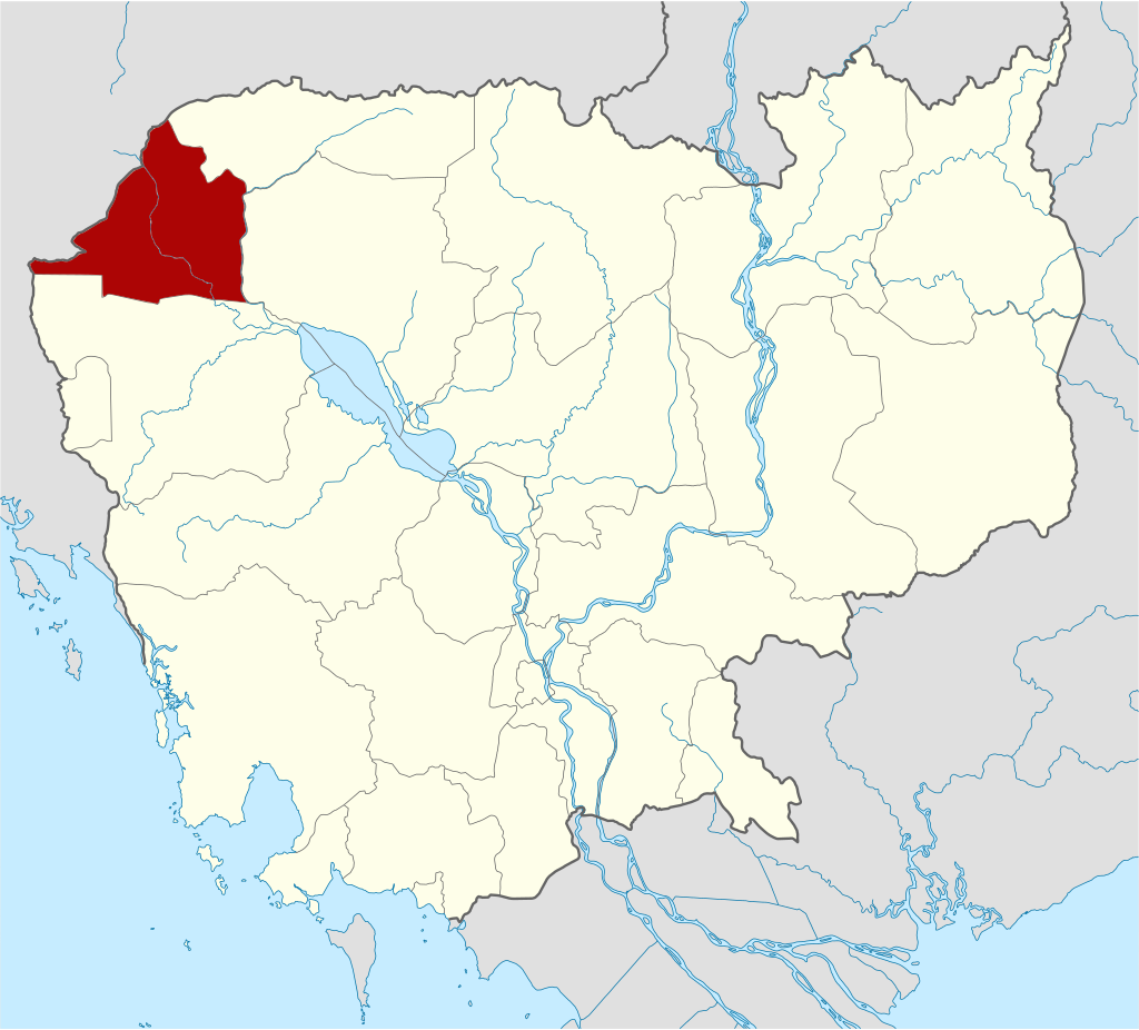
Banteay Meanchey is one of the northwest provinces of Cambodia which is 359 kilometers from Phnom Penh along National Road 5 and 6 and railway connection (approximately 337.31 kilometers). Banteay Meanchey, covering 6,678 square kilometers. Its neighboring provinces are (from north clockwise) Oddar Meanchey to the north, Siem Reap Province to the east, Battambang province the south, and Border of Thailand to the west.

Banteay Meanchey Province was established by Sub-Decree No. 32 KRC dated 23 January 1987 of the State Council and demarcated the province by Sub-Decree No. 10 dated 4 April 1987 of the Council of Ministers of the People’s Republic of Cambodia. The province was officially announced on January 7, 1988 under the chairmanship of Mr. Bou Thong, Vice Chairman of the Council of Ministers.
According to administrative sources, the name Banteay Meanchey comes from the identification of army forts (in Khmer called Banteay Korng Toip) during the 1980s, plus win or victory (in Khmer called Chhneas or Chok Chey). It was the success of the summer campaign of 1984-85. Therefore, the government of the People’s Republic of Cambodia established Banteay Meanchey as the 22nd province in 1987 and inaugurated in 1988.
Present Day, Banteay Meanchey is divided into 9 administrative districts and 2 municipalities, Serei Saophoan City (locally known as Sisophon) and Poi Pet City. The province has two international border gates, the Poi Pet checkpoint (Poi Pet City) and Stung Bot checkpoint (Stung Bot Village, Sangkart Psar Kandal, Poi Pet City) and the other three regional checkpoints, the Boeung Tror Kaun gate in Thmor Pouk District, the Malai gatein Malai district, and the Number 43 gate in O Chrov district. With over 860,000 people, the province is Cambodia’s thirteenth largest area and nineth populous. It is known for historical sites, agricultural economy, and developing infrastructure.
History
Banteay Meanchey province has a rich history that spans several centuries, influenced by various regional powers and historical events. The region that is now Banteay Meanchey has been inhabited since ancient times, with evidence of pre-Angkorian and Angkorian settlements.
Early History Period
During the height of the Khmer Empire (9th to 15th centuries), the area was an important part of the empire’s territory. It served as a strategic location for the empire’s northern frontier, with several temples and infrastructure projects initiated to consolidate control and promote religious practices. The most notable historical site is the Banteay Chhmar temple, built in the late 12th or early 13th century during the reign of King Jayavarman VII. This temple complex is one of the largest and most significant Angkorian sites outside of Angkor.
Post-Angkor Period
After the decline of the Khmer Empire, the region experienced a period of relative obscurity, with control shifting between various local rulers and neighboring powers, including the Siam Ayutthaya Kingdom. The region was often a battleground due to its strategic location between Cambodia and Thailand (Siam). In the 1795, Siam (Thailand) took control over Western Cambodia, and made the area into Siamese province of Inner Cambodia with the administration capital in Phra Tabong (Battambang).
Colonial Period
In the late 19th century, Banteay Meanchey, along with the rest of Cambodia (known as the Inner Cambodia), became part of French Indochina. As in 1907, Siam traded Inner Cambodia for the return of Trat and Dan Sai. In the same year, King Sisowath decided to split the return Inner Cambodian province into Battambang province (which included Sisophon) and Siem Reap province. When Thailand re-annexed western Cambodia in 1941, Sisophon was separated from Battambang province and became the administrative center of Phibunsongkram province until 1946, when the entire region was returned to French rule. The French colonial period brought significant changes to the region, including the introduction of new administrative systems and infrastructure projects.
Independence and Conflict Period
Following Cambodia’s independence from France in 1953, Most of parts of Banteay Meanchey still parted of Battambang province. During the Khmer Rouge regime (1975-1979), the province, like much of Cambodia, suffered from violence, forced labor, and significant disruption of social and economic life. After the fall of the Khmer Rouge, Banteay Meanchey faced the challenges of rebuilding and recovery, with many landmines and unexploded ordnance posing long-term dangers. Banteay Meanchey was separated from Battambang in 1988, and it was first divided into five districts: Mongkol Borei, Thmar Puok, Serei Saophoan, Preah Net Preah, and Phnom Srok.
Modern Day
In recent decades, the province has seen significant development, particularly in infrastructure and cross-border trade with Thailand. Efforts have been made to preserve and promote its historical sites, including the Banteay Chhmar temple, which has gained attention for its cultural and historical value.
Dignitaries who were former governors of Banteay Meanchey since 1988
There were 11 Governors of Banteay Meanchey Province from 1988-Present, including:
- H.E. Ith Loeur (ឯកឧត្តម អ៊ិត លឿ) 1988-1992
- H.E. Mounh Kosal (ឯកឧត្តម ម៉ោញ កុសល) 1992-1994
- H.E. Daung Khem (ឯកឧត្តម ដូង ខែម) 1994-1999
- H.E. Thach Khorn (ឯកឧត្តម ថាច់ ឃន) 1999-2004
- H.E. Heng Chantha (ឯកឧត្តម ហេង ចន្ថា) 2004-2006
- H.E. Orn Sum (ឯកឧត្តម អ៊ន ស៊ុំ) 2006-2008
- H.E. Ung Ouen (ឯកឧត្តម អ៊ុង អឿន) 2008-2013
- H.E. Try Narin (ឯកឧត្តម ទ្រី ណារិន) 2013
- H.E. Kosum Saroeut (ឯកឧត្តម គោស៊ុំ សារឿត) 2013-2016
- H.E. Soun Borvor (ឯកឧត្តម សួន បវរ) 2016-2019
- H.E. Um Reatrei (ឯកឧត្តម អ៊ុំ រាត្រី) served as Provincial Governor from 2019-Present
Geography
The geography of Banteay Meanchey Province is characterized by its flat plains, vital waterways, and agricultural suitability, all of which play a significant role in shaping the livelihoods and culture of its residents.
Topography: The landscape is predominantly flat with extensive plains, making it suitable for agriculture, especially rice cultivation. Additionally, the province has some upland areas and low hills, particularly in the northern parts, but these are not as prominent as in other Cambodian provinces.
Rivers and Water Bodies: The province is traversed by several rivers and streams that are vital for irrigation and agriculture. The main rivers are the Mongkol Borei and the Sisophon Rivers. Moreover, the most significant water body is the Tonle Sap Lake, located to the southeast of the province, which plays a crucial role in fishing (freshwater fishery and freshwater aquaculture i.e. Crocodile Farms) and agriculture.
Climate: Banteay Meanchey has a tropical monsoon climate with distinct wet and dry seasons. The wet season typically lasts from May to October, bringing heavy rainfall that supports agriculture. The dry season spans from November to April, with cooler temperatures in the early part of the season and hotter, drier conditions as it progresses. The province has a temperature range from 24.2 °C to 33.1 °C.
Vegetation and Land Use: The fertile plains are largely used for rice paddies and other agricultural activities in terms of Industrial Crops (red corn, cassava, mung bean, soybean, sesame, sugarcane); orchard; Horticulture (sweet corn, various vegetables, watermelon). Forested areas, though less extensive than in the past, still exist, providing timber and non-timber forest products. There are also areas of scrubland and grassland, particularly in the less developed northern parts of the province. The province homes to several protected areas (wholly or partially) such as:
- Banteay Chhmar Protected Landscape covered land area of 84,825 hectares sharing between Banteay Meanchey and Oddar Meanchey provinces (in which 45,775 hectares are in Banteay Meanchey Province)
- Rorneam Daunsom Protected Landscape covered land area of 1,423 hectares
- Ang Tror Paing Thmor Protected Landscape covered land area of 24,212 hectares
- Phnom Preah Netr Preah Natural Heritage covered land area of 13 hectares
- Phnom Yeay Som Natural Heritage covered land area of 416 hectares
- Phnom Preah Phnom Veng Natural Heritage covered land area of 1,492 sharing between Banteay Meanchey and Oddar Meanchey provinces
- Phnom Bak Natural Heritage covered land area of 36 hectares
- Phnom Chunh Chaing Natural Heritage covered land area of 19 hectares
- Phnom Svay Natural Heritage covered land area of 16 hectares
- Rorhal Kes (A Vien) Provincial Protected Area covered land area of 28 hectares
- Tonle Sap Lake Multiple Land Use covered area of 660 hectares
Administrative Divisions
As of 2024, the province is divided into 02 municipalities (Krong) and 07 districts (Srok), 12 Sangkat and 55 communes (Khum), and 661 villages. Based on 2019 census, the total population is 861,883 people (female 433,938), the number of households is 177,526, potential labor force from 15-35 years old is 62.2 percent and the density is 129 people/km2. Serei Saophoan municipality is the seat of government, commonly known Krong Serei Saophoan or Serei Saophoan City.
- Serei Saophoan Municipality (07 Sangkat)
- Poi Pet Municipality (05 Sangkat)
- Mongkol Borei District (13 Khum)
- Phnum Srok District (06 Khum)
- Preah Netr Preah District (09 Khum)
- O Chrov District (07 Khum)
- Thma Pouk District (06 Khum)
- Svay Chek District (08 Khum)
- Malai District (06 Khum)
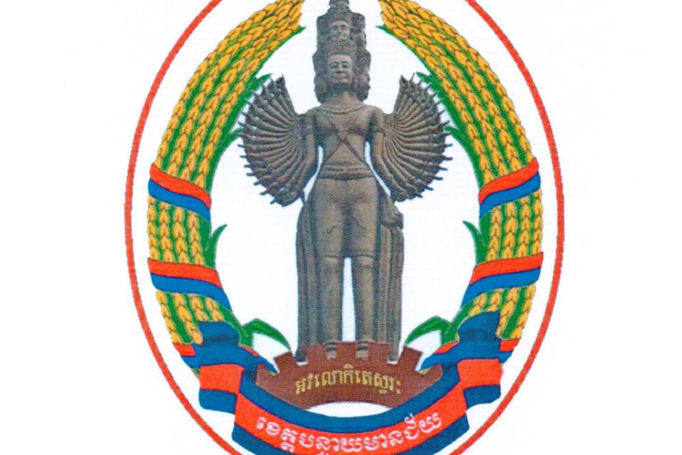
The provincial symbol is decaled by Ministry of Interior via a Prakas No.2037 BrK dated 7 May 2018 on the Establishment of Banteay Meanchey Province Symbol. The symbol has shape, size and image as follow:
- The oval-shaped with the width equal to two-third of the length
- The inner circle surrounded by the ripe rice husks in the buffalo horns shaped and wrapped in red ribbons within blue surfaces.
- In the center, there is a statue of Preah Avalokitésvara, with 32 hands, standing on a seven-spoke ratchet with the inscription “Avalokitésvara” in yellow.
- The bottom part, there is a blue ribbon where the center is a red area with the written word “Banteay Meanchey” in white.
- Avalokitésvara is the great one in anticipating or observing the well-being and behavior of creatures.
- The image of 32-Hand represents the building of the path towards Bodhi (wisdom) of a Boddhisattva to achieve the enlightenment as the Buddha
- The image of ripe rice husk symbolizes the agricultural products obtained from farming based on agriculture, with 85% of Banteay Meanchey population being farmers
- The image of seven-spoke rachet characterizes the potential factories and enterprise in present and in the future are located in Banteay Meanchey province, where most agricultural products come from agro-industrial crops such as potatoes, corn, beans, castor oil, eucalyptus and rubber. Another feature is the representation of the historic Victory Day, January 7, 1979.
Accessibility
- Road: The main road to central point of Banteay Meanchey is National Road 5, which starts in Phnom Penh (359 kilometers). Traveler can access to the province via National Road 6 from Siem Reap as well.
- Railways: The province is also served by the Cambodian railway network (Phnom Penh – Poi Pet line), which has been undergoing rehabilitation and modernization in recent years. As of July 26, 2023, there is an inaugural cross-border rail service between Thailand and Cambodia for freight.
- Waterway: Banteay Meanchey can access by river cruise from Phnom Penh via Tonle Sap River and Tonle Sap Lake. However, it is not so popular among the travelers both local and international and there is no service operation.
- Air: National Airport project is studying by private company.
Tourism Products
Banteay Meanchey Province offers several notable attractions that draw visitors interested in history, culture, and natural beauty. Here are some of the key tourist destinations:
Banteay Chhmar Temple: One of the most significant historical sites in the province, Banteay Chhmar is the 4th largest temple dating from Angkorian period after Angkor Thom, Angkor Wat, and Preah Khan Temple (in Kampong Svay). This temple complex built in the late 12th or early 13th century by King Jayavarman VII. It is located in Banteay Chhmar village, Banteay Chhmar commune, Thmor Pouk district, with about 65 kilometers from Serei Sophaon city and about 20 kilometers from the Thai border. It is made of sandstone and features intricate carvings (there is a gallery of carvings telling the story of his prince and the Champa invasion), bas-reliefs, and the iconic face towers similar to those at Bayon Temple in Angkor Thom. The temple was dedicated to Mahayana Buddhist, and is surrounded by beautiful, calming nature.
Banteay Torp Temple: Also known as the “Army of the King,” this smaller temple complex is located near Banteay Chhmar with approximately 12 kilometers. It is notable for its unique architecture and historical significance, though much of it is in ruins. Built from sandstone during the reign of King Jayavarman VII, the temple consists of five towers – a large central one attached by courtyards to four smaller ones representing the gates. The temple ceiling was partly damaged in the 1997 coup, and has wooden beams in the style of lotus flower.
Phnom Kambaor Temple stands atop a mountain in Preah Naet Preah district. The single brick building is accessed by cement staircase with a Naga handrail. Visitors will see a pile of lintel sandstone and diamond columns, while the mountain is surrounded by a moat and endless rice fields. Today, it is local shrine.
Phnom Preah Net Preah Temple is a historical site built in the Angkorian era and dedicated to Hinduism. The main tower is a shrine called Domkol Tep Temple. Some parts of the temple have been restored and it is surrounded by majestic nature.
Serei Saophoan City (Sisophon): it is one of the provincial municipalities that offers a glimpse into local life with its markets, pagodas, and everyday activities. The city serves as a convenient base for exploring the province’s attractions.
Ang Trapeang Thmor (ATT) Bird Sanctuary: This wildlife sanctuary is a haven for birdwatchers and nature enthusiasts. It is home to a variety of bird species, including the endangered Sarus Crane, and offers opportunities for guided bird-watching tours.
Cambodia-Thailand Border Markets: Located at the Poi Pet border crossing, these markets are bustling with activity and offer a range of goods, from local produce to electronics and clothing. The area provides a fascinating insight into the vibrant trade and cultural exchange between Cambodia and Thailand.
Natural Scenery and Rural Life: The province’s rural areas offer picturesque landscapes, including rice paddies, rivers, and traditional Cambodian villages; where visitors can experience the local way of life, participate in farming activities, and enjoy the scenic countryside.
Pagodas and Religious Sites: Banteay Meanchey is home to 225 pagodas and monasteries that are central to the local community’s spiritual life. Visiting these sites provides an opportunity to learn about Cambodian Buddhism and participate in traditional ceremonies.
Cultural Events and Festivals: The province hosts various cultural events and festivals throughout the year, such as Khmer New Year and Pchum Ben. These events offer a chance to experience local customs, music, dance, and cuisine.
The tourism business in Banteay Meanchey province is diverse, encompassing a range of services and enterprises that cater to both domestic and international visitors. Here are some key aspects of the tourism business establishments in the province:
Accommodation: As of 2024, 24 Hotels (equally 936 rooms) and 76 Guesthouses (equally 1,176 rooms) offer various accommodations options, ranging from budget guesthouse to mid-range hotels. 6 homestays in rural locations are part of the Community-based tourism project, allowing tourists to experience local culture and lifestyle directly.
Tour Operators and Travel Agencies: As of 2024, there are 3 companies which offer guided tours to major attractions such as Banteay Chhmar Temple, Banteay Torp Temple, and the Ang Trapeang Thmor Bird Sanctuary. These tours often include transportation, guides, and sometimes meals. Furthermore, they also provide custom itinerary planning services for visitors looking to explore Banteay Meanchey and neighboring regions.
Restaurant and Eatery Services: As of 2024, there are 29 restaurants (328 tables and 1,979 chairs) and 95 eateries (563 tables and 3,364 chairs). For local cuisine, restaurants and eateries in Serei Saophaon, Poi Pet, and other towns serve traditional Khmer cuisine, which is a significant draw for tourists. These establishments often highlight local specialties, fresh ingredients, and traditional cooking methods. For international cuisine, due to the influx of international visitors, especially from Thailand, there are also restaurants offering Thai, Western, and other international cuisines.
Transportation Services: Local transportation options, including taxis, remorque (tuk-tuks), and motorbike rentals, are available for tourists to navigate within the province. Moreover, Regular bus services connect Banteay Meanchey with other major cities in Cambodia, such as Siem Reap and Phnom Penh, as well as cross-border services to Thailand.
Entertainment Services: Poi Pet is known for its casinos, which attract many visitors from Thailand and other countries. These establishments offer not only gambling but also entertainment, dining, and accommodation facilities. Furthermore, Poi Pet and Sisophon have a growing nightlife scene with bars, clubs, and entertainment venues catering to tourists.
Handicrafts and Souvenirs:
- Local Markets: Markets in Sisophon and Poipet sell a variety of local handicrafts, textiles, and souvenirs. These items often reflect the cultural heritage of the region and make for popular tourist purchases.
- Artisan Shops: Some specialized shops and cooperatives offer handmade goods, providing tourists with unique and authentic mementos of their visit.
Other Activities:
- Bird-Watching and Wildlife Tours: The Ang Trapeang Thmor Bird Sanctuary offers guided bird-watching tours, highlighting the province’s rich biodiversity.
- Cycling and Trekking: Some businesses offer equipment rentals and guided trips for cycling and trekking, allowing tourists to explore the rural landscapes and natural beauty of the province.
- Village Tours: Community-based tourism initiatives involve local communities in offering village tours, traditional craft demonstrations, and cultural performances.
- Agrotourism: Some farms open their doors to visitors, providing experiences such as rice planting, fishing, and learning about traditional farming techniques.
Gallery

